Life & Art
Translating Taiwan's place names
- or not, since the meaning of many is lost in the prehistoric past
By Mark Caltonhill
Wulai derives from the Atayal Aboriginal words kilux ulay ('hot and poisonous')
People regularly ask me to translate the names of places in Taiwan where they live, work or visit. Common requests include such examples as Hualien (花蓮), which on the surface would appear to mean something like "Flower Lotus"; Chiayi (嘉義), "Praised for Righteousness"; and Kaohsiung (高雄), "Lofty Hero".
On some level these might be said to be correct, and at some stage this approach must have been the fashion, as one still comes across old books that use constructions like "Auspicious House, Prosperous and Peaceful Street, Spring Blossom Township, Civilisation Manifest County, Platform Bay Province". But, while this might have a superficial poetic attraction, without a great deal of background information it is clearly all-but-useless in identifying any of the places involved, which surely is the paramount, if not sole, purpose of names.
Moreover, while such "meanings" may appear to be reasonable translations of the Chinese names, ideally one needs to know more about how the appellation was given or emerged. With the exception of new names, particularly those created in the post-war Republic of China (ROC) period, this often requires research into local histories of the last 400 years and, indeed, the prehistories that preceded them, when Taiwan’s indigenous peoples managed long-lasting, complex and interacting communities (which, if we divest ourselves of modern/Western mental constructs, are probably better considered as nation states) without the need for written scripts*.
The more one looks into Taiwan’s place names, the more evident are these Aboriginal foundations. Starting at the end of the above address, for instance, (and overlooking the obsolete / PRC-assimilationist issue of "Province"), to what extent does "Platform Bay" represent the name "Taiwan" (台灣)?
Wan (灣) can pretty much only mean "bay" (though it also appears for "a bend in a stream"), and tai (台; and its more complex form 臺) can imply "platform": thus, the romantic translation to "Platform Bay" presumably.
Actually "Terraced Bay", which is an equally valid translation, might create a more interesting mental image. Or alternatively "Bay with an Observation Point (or Lookout Tower)" or even "Bay with a Theatrical Stage", however unlikely this might seem, since all these would be serviceable translations.
In reality, however, it turns out that any such translation would be erroneous, since "Taiwan" merely functions for its phonetic not semantic value, that is, it represents a transliteration of a pre-script (ie prehistoric) Aboriginal tribe’s name (the meaning is lost, but an, which is a fairly common suffix, perhaps denotes a "place"), which was located on a sandbar that is a part of today’s Tainan (台南). This was written in 17th-century Dutch texts as Tayouan (and similar spellings; and later Tywan by the British) and was taken up by Han-Chinese immigrants as Tai-oan, written using 大員 (and similarly pronounced characters). The current 臺灣/台灣 became the standard after the Qing court finally defeated the Zheng-family Tongning (東寧) State in 1683, after the latter had kicked the Dutch out in 1662.
Tayouan, that is, Tainan, was where the Dutch East India Company established its headquarters at the beginning of its four-decade stay on Taiwan, and its continued pre-eminent position during the subsequent Han-Chinese colonisation of the island presumably accounts for this once-local name coming to represent the whole territory.
This Dutch role in the use of Tayouan for the whole island represents almost the beginning and end of Westerners’ contributions to Taiwan’s place names, along with Ilha Formosa, meaning "beautiful island", which was given by the Portuguese as they passed by but didn’t stop to set up camp. The very few other examples tend to catch Western visitors’ eyes, however, so although they represent an exception in Taiwan’s appropriation of place names rather than the rule, please forgive a momentary digression.
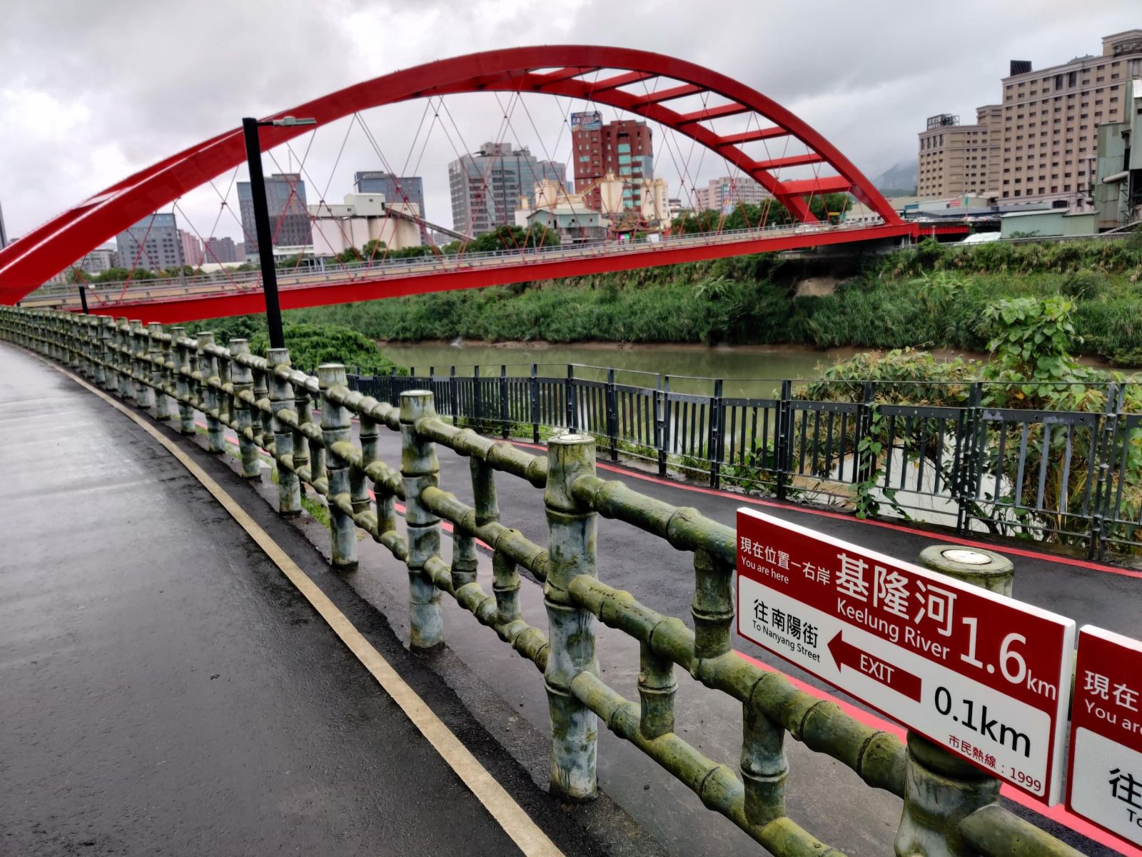
Most obvious even to a transitory visitor is probably Roosevelt Road (羅斯福路) in Taipei City, named after 32nd US President Franklin D Roosevelt, for his financial and diplomatic support for Chiang Kai-shek and the ROC. This may confuse visiting Illinoisans, since Roosevelt Road in Chicago honours 26th President Theodore Roosevelt. Earlier than this, however, was the MacArthur Thruway (麥克阿瑟公路) linking Taipei with Keelung, but today the only remnants of this are the MacArthur Bridges (麥帥一/二橋) at the Taipei end that still recognise the US general’s support for the ROC at the key moment when the KMT had just been forced to leave continental China after being defeated by the Communists.
Keelung city and river are not, as claimed, named for resembling a 'chicken coop' but most likely is a shortened form of 'Ketagalan', the local Aborigines
Like the Dutch entrepot in the southwest, there was an even smaller Spanish colony in the northeast around today’s Keelung. Although it only lasted from 1626 to 1642, it has left occasional legacies among Taiwan’s place names. Most notable is Sandiaojiao (三貂角), Taiwan’s easternmost point, where the northern end of the Xue Mountain (雪山) Range meets the sea and where the invading Spanish forces landed in May 1626, naming it Cape Santiago.
Today there is a lighthouse at Sandiaojiao, as there is at the island’s northernmost point, Fuguijiao (富貴角) near Shimen (石門; "stone door", named after an erosion-created arch) in New Taipei City. Fuguijiao, or rather its original Hoklo Taiwanese pronunciation of Hu-gwee Gak, represents the tautological combination of a transliteration of the Dutch hoek, meaning "corner" (which was used for "cape" until the Portuguese word cabo was later absorbed as kaap) plus translation of the same word into Chinese as 角, which also means "corner" but is similarly used for capes. A nearby sign states this derives from the presence of Dutch engineers employed to build a lighthouse at the beginning of the Period of Japanese Rule (1895-1945); Wikipedia says they were hired to lay undersea cables from Japan to its new colony; but Abe Akiyoshi (安倍明義), whose "Research on Taiwan Place Names" (台灣地名研究) is generally reliable, says that a map in Dutch missionary records from 1726 identifies it as Hoek Van Camatiao, from which the name derives.
Perhaps more interesting still are Wangtian (王田) and Liujia (六甲), the latter in Tainan, the former in Tainan and Taichung and, possibly elsewhere, since, meaning "King’s field", they date from the Dutch period where all overseas colonies were considered the possession of the monarch. These were then managed by the Dutch East India Company, which auctioned licenses for the collection of taxes to local Han-Chinese, who acted as primary tenants, exacting revenues (or operating a trade monopoly) from local people with which to pay the company and make a profit for themselves, a system known in Dutch as pacht, which refers to the "leases" used for the taxation of farming, and which was transliterated into Hoklo as pak (贌; Mandarin pu). The rationale was to outsource taxation to the private sector, and thus protect the colonial authorities from friction with their local subjects. While this may have succeeded, it led to a great deal of friction and even to armed uprisings against the rent collectors who often abused the monopoly system, particularly when dealing with Aboriginal communities. Nevertheless, it was continued for more than seven decades by the succeeding Zheng-family and Qing government, until abolished in the 1730s. Thus, there are not only townships still called Wangtian, but also Guantian (官田; "official fields"), some of which were simply Wangtian renamed by the Zhengs.
Jia (甲; Hoklo: kah) derives from the Dutch word akker meaning "field", cognate with the English word "acre", the area of land that can be ploughed by a yoke of oxen in one day. It was similarly adopted in Taiwan and defined as being equivalent to 10 畝 (mu). Interestingly, the roughly equivalent Chinese word 犁 li, which originally meant "plough", also came to indicate an area that could be ploughed. Taipei has Liuzhangli (六張犁; "six li") and Sanli (三犁; "three/third li"), and Taichung and Taoyuan both have Bazhangli (八張犁; "eight li).
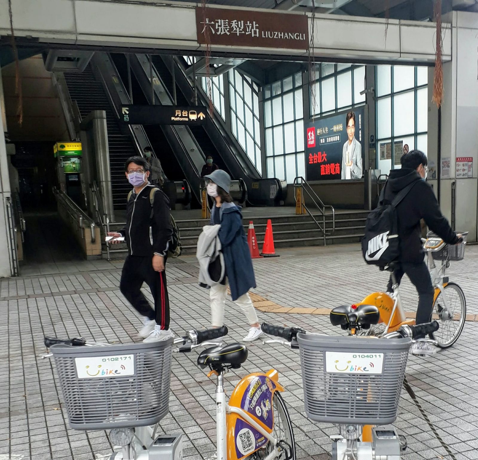
Liuzhangli ('six ploughed areas') suggests this part of Taipei was rural until recently
Liujia, to the northeast of the Dutch headquarters at Tayouan (now Anping District), was not an area of "six kah" but the "sixth kah" of several in this area. References to the First, Second and other kah can be found in nearby village and even street names. Xuejia (學甲) on the coast might appear to mean "academic kah", that is, the home of tenant farmers whose son passed the imperial examinations, but Abe Akiyoshi says it derives from transliteration of the name of a small Aboriginal community.
This nicely ends what was developing into an over-long digression into Western-language contributions to Taiwan’s place names and returns us to the standard pattern that accounts for the vast majority of names.
For an archetypal example of the process of creation, adoption, and evolution, one needs look no further than Taiwan’s largest port city of Kaohsiung (高雄), which, as noted above, appears to mean something like "Lofty Hero". In fact, these characters were only ascribed to the city in southern Taiwan in 1920, roughly midway through the Period of Japanese Rule, and the pronunciation Gaoxiong (albeit spelled Kaohsiung) to the post-war period. And yet there is a constant thread of preservation of earlier names that runs continually for more than four hundred years.
The original Aboriginal name of this area was Takau, which in the Siraya language perhaps meant "bamboo forest" or was short for Makatao, a tribe within the Siraya group. In any case, immigrating Hoklo-speaking Han-Chinese preserved the pronunciation, transliterating Takau by means of the characters 打狗 (literally "hit the dog"). Fast-forward to the end of the 19th century, when the incoming Japanese colonial authorities for a while tolerated this "inelegant" name which, in any case, would be pronounced in Japanese as something like da-inu. Later, to preserve the pronunciation, they changed the characters to 高雄 (Takao), since there is also a mountainous area of that name near Kyoto. Perhaps to avoid issues arising from differences between the Hoklo and Mandarin dialects (not to mention Hakka and Aboriginal languages), the incoming ROC regime of 1945 chose to preserve the Japanese written versions of most place names, which thus led to Kaohsiung, and the preservation of neither sound nor meaning of the original, although Takao is increasingly used by local people and businesses.
This, then, is the blueprint for a great many place names in Taiwan, with the Aboriginal pronunciation being approximated with Hoklo (or Hakka) characters, then with Japanese characters, which are subsequently retained, albeit with a completely new pronunciation.
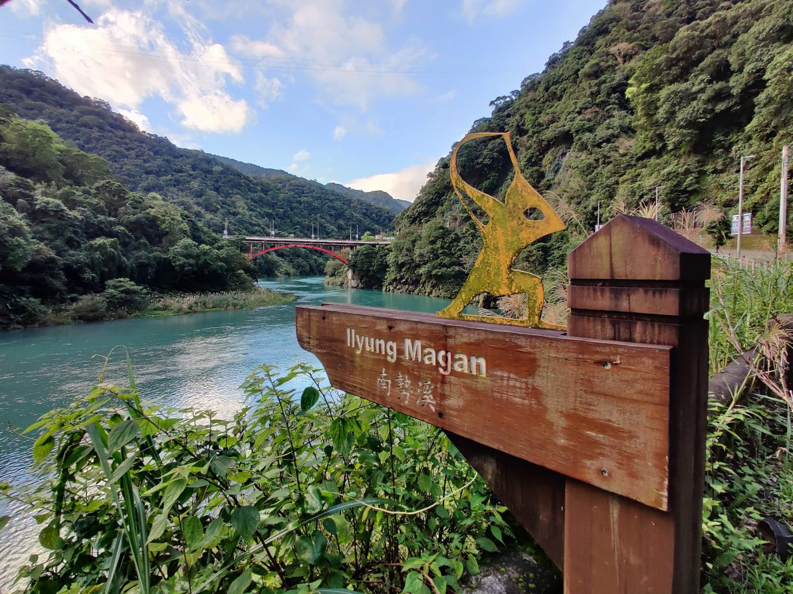
Sometimes the original Aboriginal name appears on signs, such as this for the Nanshi River at Wulai
Hence Vanka, an Aboriginal word for the "canoes" used to bring foodstuffs and charcoal downriver to the outskirts of modern Taipei to trade with Han-Chinese, became Bangkah (艋舺) in Hoklo, then Banka (萬華) in Japanese, and finally Wanhua (萬華) in Mandarin, meaning "ten-thousand flowers".
Evolution of Hualien’s name has a slight twist. The original inhabitants were Sakiraya people, from which Han-Chinese immigrating in the mid-19th century derived Kilai (奇萊; Mandarin Qilai). Since this sounds like "dislike/disgusting" in Japanese (嫌い, kirai), the colonial government chose another name that had been used for the area, Hoe-lian (洄瀾; "eddies" that described the way the Hualien and Mugua river waters whirl as they meet the incoming tide in the estuary) albeit with the different characters 花蓮. Pronounced Karen in Japanese, this then is today’s Hualien. Do we really want to translate this as "Lotuses"?
Some examples would be almost impossible to guess. A recent translation I worked on concerned the Paiwan Aboriginal tribe of Wenle (文樂) in Pingtung County. But this also seemed to be called Pucunug (which interviews with today’s elders by Academia Sinica archaeologist Kuo Su-chiu suggests may have meant "Please cherish us because our population is small") before it had been forced down from the mountains by the ROC government in the 1950s. Eventually Kuo figured out that Pucunug had been transliterated in 17th-century Dutch records as "Patlong", by Han-Chinese as 布初諾庫 (Mandarin: Buchunuoku) among other things, which became Butsunroku in Japanese, but was misidentified on a 1924 map as Buroku, which was written in Japanese as 文樂, from which the incoming ROC administration of the post-war period preserving the written form thus derived Wenle. Apparently residents of the tribe still call it Pucunug.
A great many place names, even following this formula, are fairly straightforward. Madou in Tainan started life as the Siraya village of Moatau, appeared in Dutch records as Mattau, was written in Chinese as 麻豆 (Ma-dou; literally "numb beans"), survived unaltered through the Japanese period presumably because of the similar pronunciation of Matō, and is once again Madou today.
Working out such evolutions can be fun as one travels around Taiwan.
Not all names follow this pattern of course, and each immigrating group or governing authority assigned their own appellations as they saw fit.
Sometimes these describe features of the natural environment, like the above-mentioned Shimen (石門; "stone archway") or Shenkeng (深坑; "deep gorge"), Shuangxi (雙溪; "pair of rivers"), and Xizhi (汐止; "end of tides"), which is the highest reach of the tidal zone on the Keelung River, some 30 kilometres above the estuary at Danshui (淡水; a.k.a. Tamsui--one of few place names where the Hoklo spelling is the official English--meaning "fresh water"). Xizhi is fairly modern, being a Japanese-era gentrification of the earlier less elegant Shuifanjiao (水返腳; Hoklo Tsui-tng-ka: "water-returning point").
Many small villages developed from the original immigration of a single Han-Chinese family and still bear their clan names. These often refer to the original homestead, and are very similar to toponyms in other countries, such as the Davidson Mains district of my own city of Edinburgh, which was a "mains" (an estate’s home farm) founded by one William Davidson in the 18th century.
Thus, among the many dozen such examples, there are city districts and rural villages named Pengcuo (彭厝; "Peng’s House") in Taipei, Wucuo (吳厝; "Wu’s House") in Taichung and Liucuo (劉厝; "Liu’s House") in Kaohsiung; as well as Luwu (呂屋; "Lu’s House") in Taoyuan, Shenwu (沈屋; "Shen’s House") in Hsinchu and Zhengwu (鄧屋; "Zheng’s House") in Miaoli County. Zhengzailiao (鄭仔寮; "Zheng’s Cottage") in Tainan is something altogether different, and Abe surmises that it was "very possibly" derived from a villa used by Koxinga’s son and successor as king of the late-17th-century Tongning State, Zheng Jing (鄭經).
The reason for using either 厝 or 屋, according to Professor Lay Jinn-guey (賴進貴) of the Department of Geography at NTU writing in a 2017 National Geographic article, is that 屋 is common in Hakka areas (primarily Taoyuan, Hsinchu, and Miaoli) and 厝 in Hoklo-speaking communities.
Linguistic differences between Chinese regionalects commonly appear in place names; Abe notes, for example, that the 壢 (li) of Zhongli (中壢) in Taoyuan is typically equivalent to the 坑 (keng; "pit / gorge") we saw in Shenkeng (深坑) above.
Incidentally, Professor Lay found 49 examples of Chencuo (陳厝; "Chen’s House") in Taiwan, making it the 6th most common topographic name, not far behind Gongguan (公館; literally "Public Hall", but which was a large house, usually belonging to the head local official) which ranks 3rd with 65. By far the most numerous with 94 examples is 竹圍仔 (Tik-ui-a in Hoklo; literally "bamboo encircled"), which refers to the use of thick clumps of bamboo to surround one’s home to keep out the wind or one’s enemies. However, there are as many as 318 if variants such as the basic 竹圍 are included, as well as "large" 大竹圍, "lower" 下竹圍 and other forms.
Occasionally surname-derived places have grown much larger, however, such as Su’ao Township (蘇澳鎭; which has a population of almost 40,000) in Yilan County, or more important, such as the Zengwen River (曾文溪; at 146km in length, Taiwan’s 4th-longest) and Reservoir (曾文水庫; with a capacity of 708 million m3, Taiwan’s largest) in Chiayi and Tainan counties.
The latter is named for one long-forgotten Zeng Wen (曾文). Abe only records him as having opened up land for cultivation here, but Wikipedia’s Chinese-language page says that he did so during the 17th-century Dutch period before going on to operate a ferry. Old Western maps call it the Soulang River, but sometimes the Zant River, which was perhaps a rendition of the Hoklo pronunciation Tsan of the surname 曾 (Mandarin: Zeng).
The former, 蘇澳 (Su’ao; meaning "Su’s Bay"), according to Abe, derives from someone called Su Shi-wei (蘇士尾) who had "led people to immigrate here more than 100 years ago" (Abe did his research in the 1930s). But Wikipedia suggests a second possibility: that Spanish came down the coast from Keelung and called this place San Lorenzo, which became 路連蘇 (Lu-lian-su) in Chinese, and hence Su.
I am not a historian, just a translator for historians among others, so I wouldn’t possibly dare to adjudicate on such matters.
Speaking of history (apologies for my clumsy segue), clues to Taiwan’s historical development of the last 400 years are littered throughout the island.
Several places named Shipai (石牌), including the MRT station in Taipei, refer to occasional surviving Qing-dynasty stone posts that demarcated lands reserved for Aborigines from those in which immigrating Han-Chinese could operate, though their modern locations are often not their original positions. Moreover, for long periods they were pretty much ignored, leading to the boundaries being repeatedly moved, and Aboriginal lands repeatedly shrinking.
Xinying (新營; literally "New Camp") is typical of a number of towns surrounding Tainan in containing the character 營. This reflects the presence of military-farming colonies established to semi-demobilise his invading army by Koxinga (a.k.a. Zheng Cheng-gong; 鄭成功) after defeating the Dutch in 1662. Others include Jiuying (舊營; "Old Camp"), Zhongying (中營; "Middle Camp"), Houying (後營; "Rear Camp") and so forth, as well as Zuoying (左營; "Left Camp") in Kaohsiung. Tun (屯) were similar military colonies, as were zhen (鎮), such as Houzhen (後鎮) at Xinying, but many of Taiwan’s "Tun" seem to be recent appellations, and "zhen" is also the word used in Taiwan for "rural townships" which can be misleading.
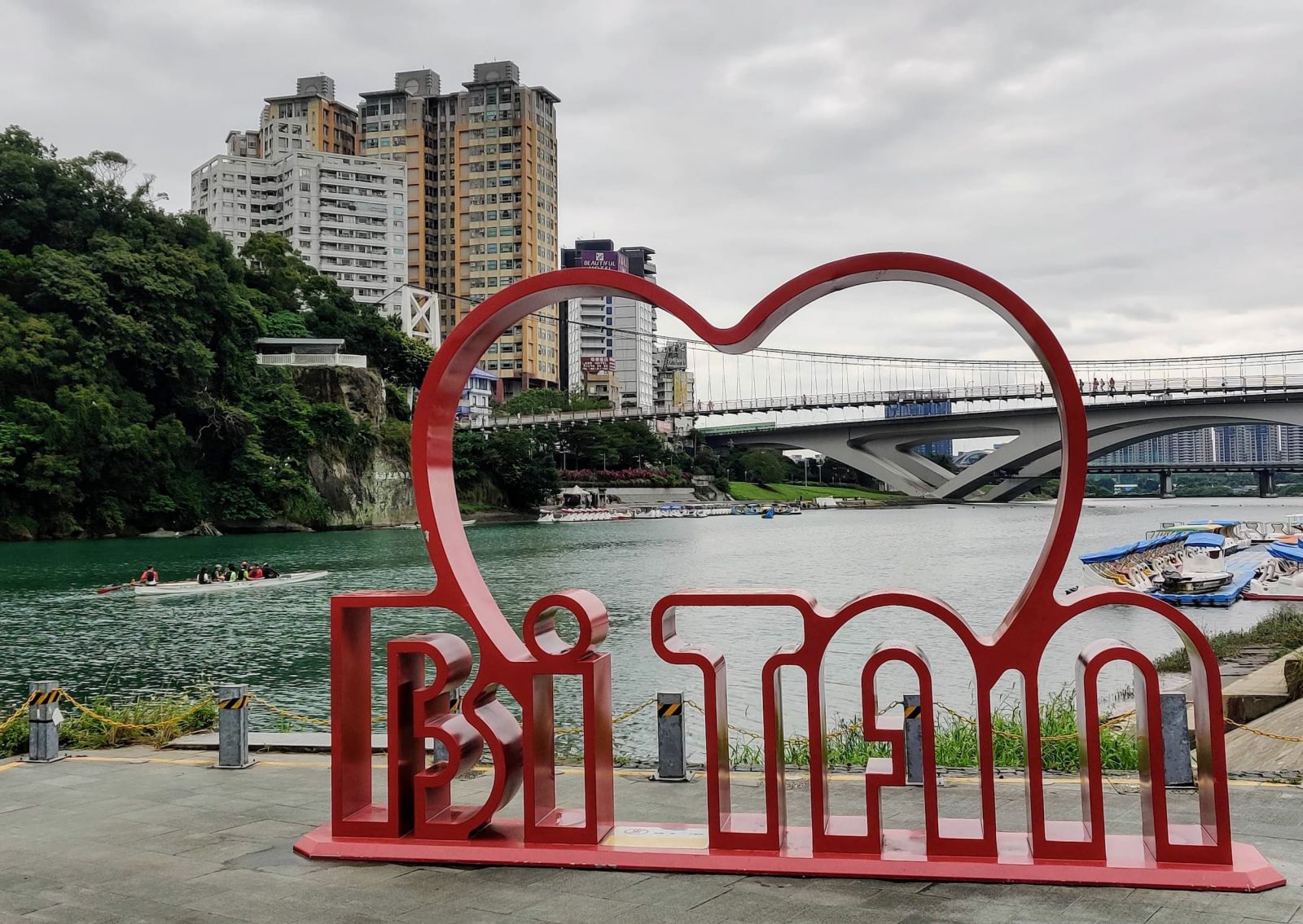
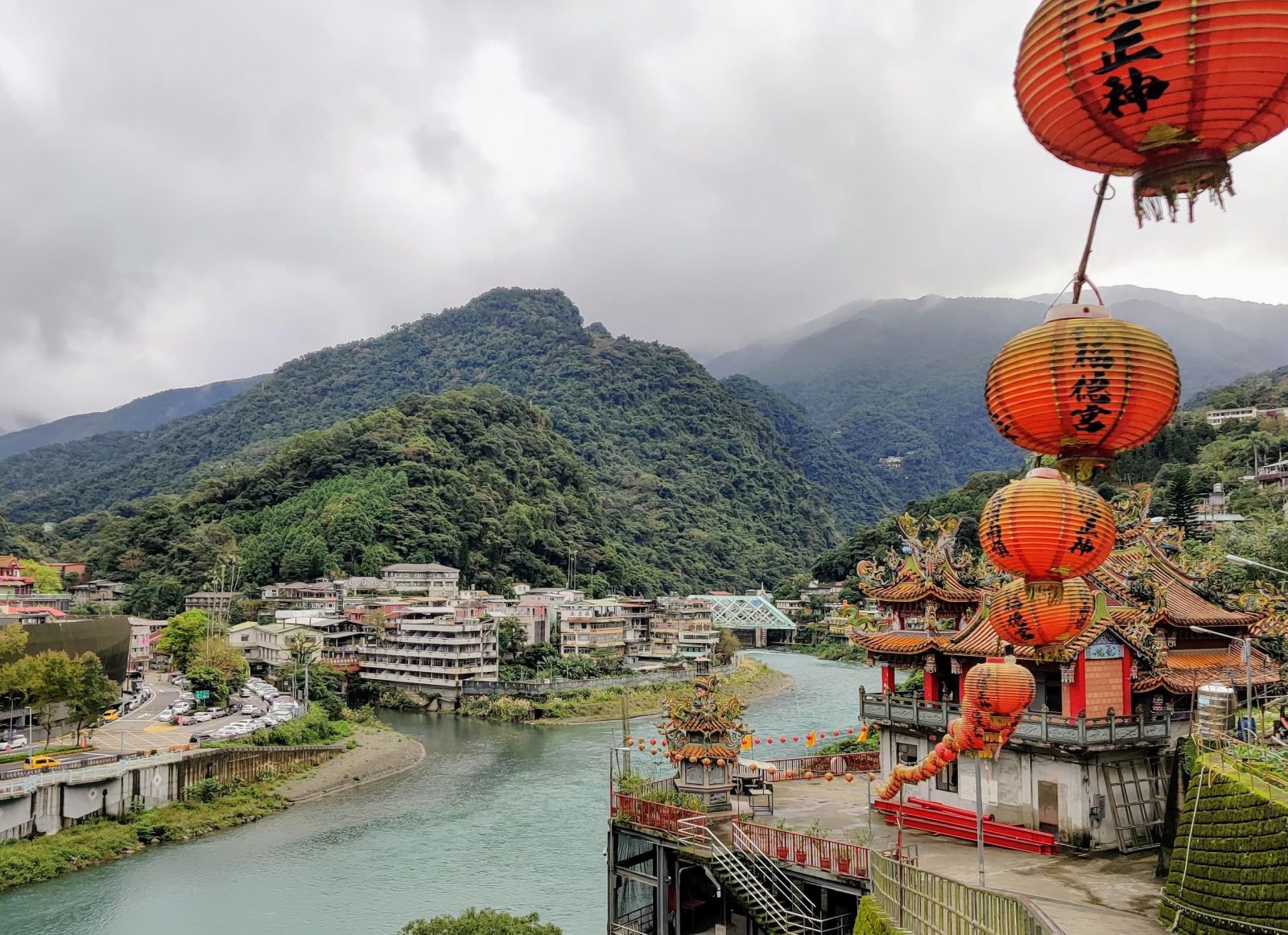
Bitan ('Green Lake') was so renamed at a poetry gathering and became one of Taiwan's Eight Scenic Spots
Chiayi (嘉義), that I started this article by superficially translating as "Praised for Righteousness" turns out to be exactly that, while "Civilisation Manifest County" that I found in the second-hand book inscription, presumably refers to Changhua (彰化).
This latter, originally a settlement of the Babuza Aborigines pronounced Pasua was transliterated by immigrating Hoklo as Poasoa (半線; literally "half line"), for whom it became the main commercial and economic center of central Taiwan before the rise of Taichung. The name-change to Changhua in 1723 followed the Qing court’s eventual suppression of the Zhu Yi-gui Rebellion, and was intended to be a "manifestation of royal civilisation" that replaced the preceding chaos.
Similarly, Chiayi’s final renaming from the earlier Tsulo (諸羅), shortened from Tsulosan (諸羅山; Mandarin Zhuluosan), itself a Hoklo transliteration of the Hoanya Aboriginal name Tirosen, also resulted from a rebellion, this time resisted by the local citizens. Forces under rebel Lin Shuang-wen (林爽文) attempted to storm the town in 1786 but failed to overcome the inhabitants, who were rewarded the following year by imperial "commendation of [their] righteousness".
From here there are still a range of categories not covered (topographical features such as the numerous Yuanshan (圓山; "Round Hills") and Jianshan (尖山; "Pointed Hills") spring to mind, or towns named after local temples such as Guanmiao (關廟) and Guanyin (觀音), but this ramble has gone on long enough even though we have barely scratched the surface. Moreover, I have just accidentally returned pretty much to my point of departure, which always makes for a satisfying ending to an article. If readers are interested in learning more, there are still thousands of names to explore. Enjoy.
Mark Caltonhill is a Taipei-based British translator and writer
* Taiwan’s Aborigines were exposed to many outside influences in prehistoric times, from which they selectively adopted new technologies, such as iron and bronze metallurgy, and so historians now reject earlier narratives of "primitive Aborigines incapable of learning to read and write".
